A succession of extreme weather events have happened in the Mediterranean basin since the beginning of October.
Generally, when Arctic air flows in the Mediterranean during fall, when the sea temperature is still warm, which is especially true this year with an average water temperature above 20°C, the coast can be impacted by severe episodes of quasi tropical storms.
Storm Adrian which swept the south of Europe on Monday October 29 caused very strong winds, particularly in Corsica, and exceptional snowfall on the Massif Central with a cold intensity rarely equaled by late October.
This situation is the result of very cold air of polar origin extending to the Mediterranean which encountered hot air from Tunisia to Italy. It was this violent conflict that caused strong instabilities. Thanks to a persistent high pressure field in Europe, this particular configuration has allowed these low pressures to form intense and slow-moving storms.
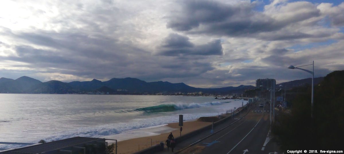
Peaking at 980hPa between Var and western Sardinia in the early afternoon of Monday, Adrian produced very rainy and windy thunderstorms between Var, Alpes-Maritimes and Corsica in the morning. In addition to locally important downpours (sometimes 80/100 mm in 3h near Cap Corse), hailstorms and violent gusts have been recorded (locally 100/130 km/h during thunderstorms). Maximum gusts of wind reached records with a peak at 189 km/h at Cape Pertusato. A tornado was officially reported in Tanneron at the limit between the Var and the Alpes-Maritimes. Strong waves have also caused a lot of damage and some floods have been observed locally on the most vulnerable parts of Corsica and the French Riviera.
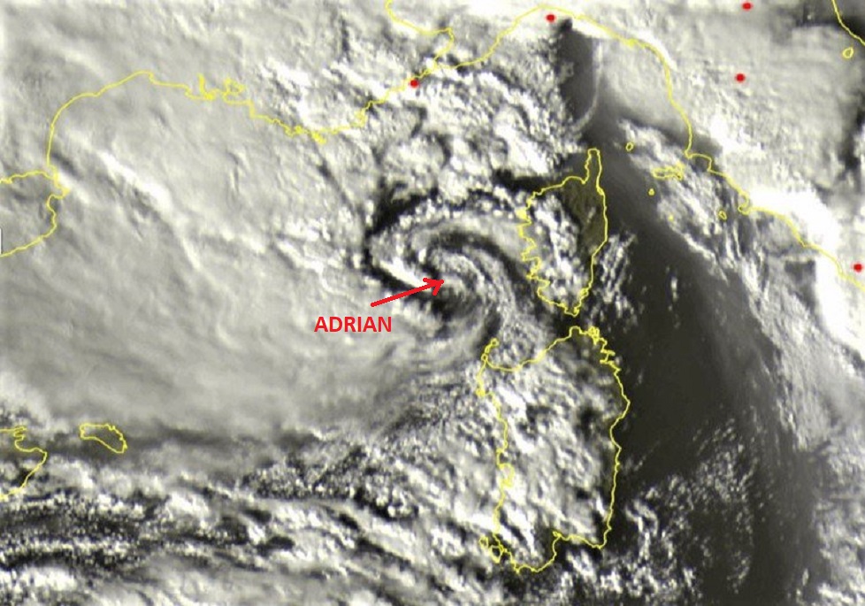 <- Adrian took a form almost cyclonic arriving on Corsica developing an "eye" quite clearly defined (source: sat24)
Important snowfall were particularly significant in other parts of the country for this time of year. These snowfalls were first brought by the shock between the warm stream coming from the south and cold air at the level of the Massif Central, producing severe cold weather. With an average temperature of 6°C, this is the coldest ever observed in October in France. It was colder than in the heart of winter in most of our regions, except in the southeast.
If Corsica and eastern side of the french Riviera were the most severely affected areas, the storm did not stop at the border. In Liguria, damage are even more spectacular. The region of Genoa, where the wind broke records up to 180 km/h, was the most impacted. Wind gusts exceeded 115 km/h in some areas ripping trees, destroying several boats, damaging coastal infrastructures and suspending train traffic. Residents of the old port of San Remo had to be evacuated at night due to the threats of storm surges. At least nine people lost their lives as a result of Adrian hitting Northwest Italy.